Thursday, May 14, 2015

Marin Headlands Wildflowers Hike at Muir Beach


Hike: Coastal Trail/Green Gulch Trail Loop from Muir Beach
Hike Difficulty: Moderate to Strenuous (lots of climbing)
Hike Distance: A little over 5 miles or almost 7 miles (this depends on whether you cut over on Coastal Fire Road or Tennessee Valley Trail)
(I recommend printing out the Marin Headlands Trail Map before you go on this hike because the map at the trailhead is only for a very small portion of the area. It does not cover this entire hike.)

We've hiked the shorter and longer loops and both are great. If you end up out here on a beautiful, clear day, I recommend taking the longer loop. On Sunday, it was pretty cold and windy, so we opted for the shorter hike. You still get your heart rate going good on the hills, great views and the unique experience of walking right through Green Gulch Farm. 

For the shorter loop, we started out on the Coastal Trail for 1.9 miles. As the name suggests, we were right along the coast. This trail has a lot of ups and downs, but you have views the entire time. It's pretty awesome. 

 View of Muir Beach from Coastal Trail


The Coastal Trail up ahead

We went left onto the Coastal Fire Road. At the Fox Trail, we turned left and then shortly after turned right on Coyote Ridge Trail. Then we took the second Green Gulch Trail (not Middle Green Gulch). When you get to the farm, it is tricky. We've done it a couple ways and we always feel lost. Don't worry about it. I get the impression that as long as you are quiet and respectful, it's fine to just keep walking until you meet back up with the trail on the west end of the property. While you are there, take your time admiring their beautiful gardens and greenhouses. 

We've hiked here multiple times at different times of year. I did not expect to see so many wildflowers on this May Day. I highly recommend going to check them out if you love wildflowers as much as I do! 

I love wildflowers and taking pictures of them, but I don't claim to be an expert. If you know what a flower is that I don't name, or you think I'm wrong with the name I provide, please feel free to comment! I'd love to learn more. 

 Columbine

 Lupine - definitely made me think of Milford Sound


 Indian Paintbrush - My absolute favorite

Sweet peas - definitely a reminder of our wedding day

More lupine? How incredible are the colors on this one? 


Before they become flowers

 Muir Beach from Green Gulch Trail

Douglas Iris


The rest of my pictures are from beautiful Green Gulch Farm. 


We didn't do it this time, but one of the coolest things about this hike is that the Pelican Inn is right at the end of the hike. You can get a drink there, sit out on their beautiful lawn, and relax a bit after your long hike.

Friday, February 13, 2015

Fairyland Loop at Bryce Canyon National Park

Hike: Fairyland Loop 
Hike Difficulty: Moderate/Strenuous
Hike Distance: 8 miles
Time (Round Trip): 4-5 hours
Elevation (Min/Max): 7163ft/8152ft
Elevation Change: 2309ft climbing and 2309ft descending

If you can only do one hike at Bryce Canyon, I think I would recommend the Figure 8 Loop. It is just so big and impressive. However, it also has a lot of crowds at the beginning and the end. If you have some extra time and want to get away from the crowds and feel like you've really seen all this amazing park has to offer, definitely do the Fairyland Loop. We saw very few people on this hike, and it's long enough that I really got into that hiking zone in my head. That mental state where I never want the hike to end and that this is what life is about. 

The National Park Service website describes this hike as starting at Fairyland Point and taking the loop clockwise. We started at Sunrise Point going counter-clockwise. Either way, you spend the last 2.5 miles on the Rim Trail. Although there are incredible views from the Rim Trail, it does seem like a little bit of a slog at the end there. Keep in mind I haven't done it this way, but I might recommend starting from Fairyland Point and hiking the Rim Trail first. That way you get those views first and then head down to experience all the hoodoos and wildflowers close up.  

I will be describing our hike as starting from Sunrise Point. We parked in the Sunrise Point parking lot and easily found the Fairyland Loop Trail off the Rim Trail (it depends on where you park whether you'll head north or south on the Rim Trail to find the Loop Trail but hopefully you'll have a map and can find it no problem!)


After about a mile and a half, there will be a sign to turn off for Tower Bridge. Definitely worth a quick stop, but I would have felt a little disappointed if I had hiked just to see it.

Tower Bridge

After viewing Tower Bridge, we made our way back to the loop and continued right on the trail. There isn't much in the way of tricky navigating on this loop hike, so I am not going to detail all the twists and turns. We just followed the trail and all its ups and downs until meeting back up with the Rim Trail.

Weirdest flower ever. Like gumdrops or gummy bears.


Our lunch spot 


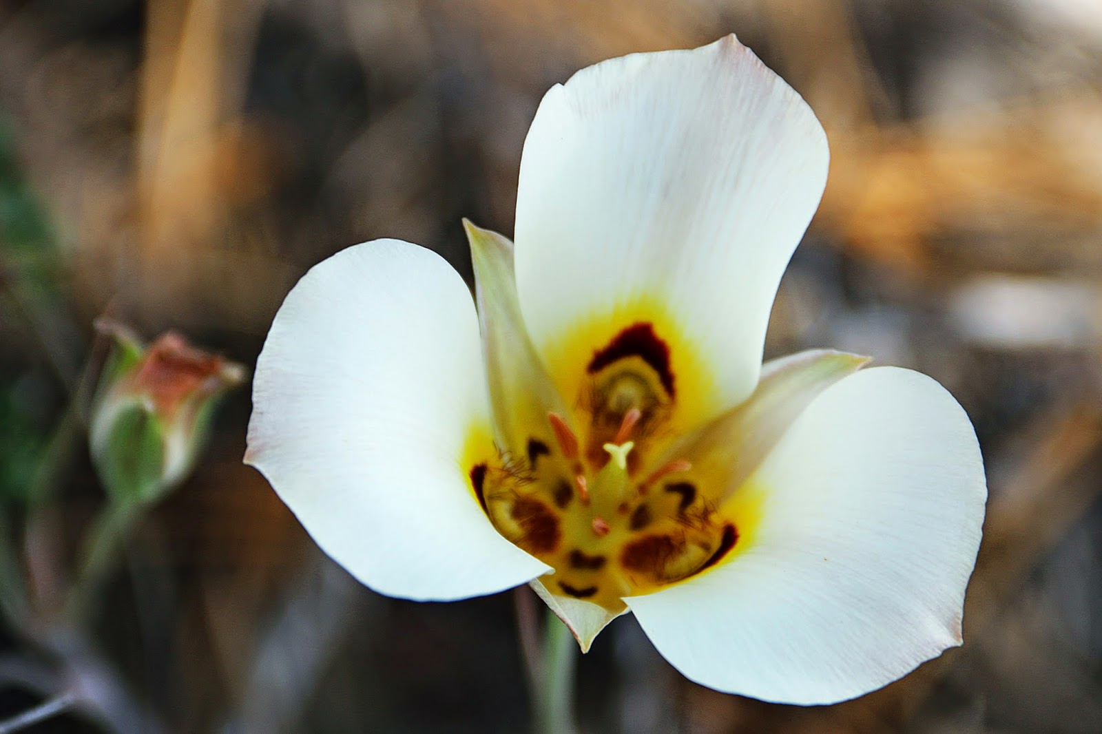
Once we climbed back up to Fairyland Point, we went left on the Rim Trail and made our way back to Sunrise Point. I was so excited to find an abundance of Sego Lilies (Utah's state flower) along this section of the Rim Trail.


After our hike, we spent the rest of the afternoon hanging out at our campsite at Sunset Campground. We hung our hammock and took a nap in the sun with the breeze making beautiful music in the trees.

After having an early dinner, we decided to check out some of the viewpoints in the southern portion of the park. Favorite viewpoints were Rainbow Point (the one all the way at the end of the road) and Bryce Point (the highest point in the park).

Rainbow Point? 

The Grottos

Bryce Point 

Best View of Bryce Amphitheater! 

It was really fun to drive out this way and look down on all of the places we had been hiking over the last couple days. We could definitely see some of the trails and follow them winding their way through the hoodoos.