Sunday, April 20, 2014

Occoneechee Mountain Loop Trail

Hike: Occoneechee Mountain Loop Trail at Occoneechee Mountain State Natural Area
Hike Difficulty: Easy to Moderate
Hike Distance (Round Trip): (supposedly) 2.2 miles
Time (Round Trip): 1-2 hours
Elevation: A whopping 867 feet! (Highest point in Orange County, North Carolina)

We didn't move to the Piedmont of North Carolina for the hiking. There are a lot of other fantastic things to do here and I will miss Durham when we leave, but I won't really miss the hiking. That being said, there are some great trails to go out and enjoy if you are ok without big sprawling vistas and with lots and lots of trees (which come along with lots of roots in the trails, so you have to watch your feet). Spring is the perfect season for hiking around here, because all of the trees are flowering and turning green but there isn't so much vegetation that the sun can't get through. And of course, most importantly, the humidity is low and the insects and spiders are not out in full force yet. 

We had never been to Occoneechee Mountain State Natural Area before, but had a very lovely morning hike there this April weekend. The trail is pretty easy to follow and they have trail maps that you can take with you at the trailhead parking lot (see driving directions at the end of this post), so I'm not going to go into great detail with step-by-step directions for the hike. 


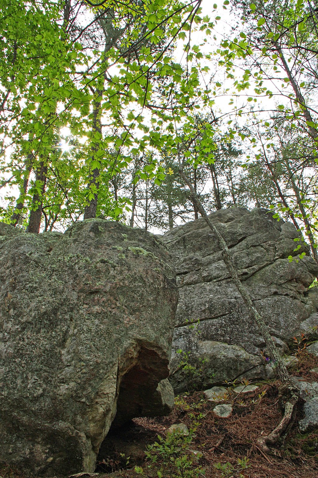
We hiked Occoneechee Mountain Loop Trail clockwise and started at the trailhead up the hill from the bathroom and trail map stand.  Along the way, we saw many cool rock formations. At about a mile or so in, the trail follows along the Eno River for awhile before heading back up the "mountain" towards the lookout. I recommend taking little side detours to see the Occoneechee Quarry and the lookout over the Eno River. 


 Amazing bark on a tree that we had to climb over on the trail. 


At the sign below, we went right to explore the abandoned pre-Civil War era quarry. The quarry rock walls are composed of sericite, quartz, and pyrophyllite minerals, which makes them a white-ish color.


After checking out the quarry, we headed back to the trail sign and continued on (and up) the Occoneechee Loop Trail.


Hard to escape signs of civilization on hikes in the Piedmont, but it didn't seem to bother me much on this hike. We could hear Highway 85 for the first little bit of the trail, but mostly it was wind blowing through the trees and quite pleasant.

At the junction below, we continued straight toward the lookout and then came back to this sign and continued on the Loop Trail. There are other trails that could be short cuts, but we wanted to complete the loop.


View of the Eno River from the Lookout

Driving Directions from Durham
1. Take 85 South to exit 164 for Hillsborough.
2. Turn right on Old NC 86. 
3. Turn left on Mayo Street.
4. Turn left on Orange Grove Road.
5. Turn right on Virginia Cates Road. Continue on this road past a little pond (look for turtles!) until you see the parking area on your left. There are signs for Occoneechee Mountain after you get off 85 and they are really easy to follow. 

Thursday, February 13, 2014

Ice Magic

I'm not really sure I can call this an adventure. We only walked about a quarter of a mile through the ice covered snow in our neighborhood. But in North Carolina, this is a rare treat. It was quite magical and I'm glad Ally and I both got to stay home to enjoy it today!


 I think this looks like it belongs at the Chihuly Glass Museum


 Not quite spring

 Grass Icicles!


 Ice patterns on our wrought iron outdoor furniture


Tuesday, February 4, 2014

Ship Peak Hike on Orcas Island

Hike: Ship Peak Loop in Turtleback Mountain Preserve
Hike Difficulty: Moderate 
Hike Distance (Round Trip): about 3 miles
Time (Round Trip): 1.5-2 hours
Elevation: Ship Peak 931 feet

In previous posts, I gushed about Turtleback Mountain Preserve and how incredible it is. We went on two hikes in the preserve when we were on Orcas Island in December. Details about our hike in the north section of the park can be found here. We enjoyed Turtlehead Hike in the north section of the park so much that we made sure we had time to go on another hike before leaving on the ferry at 12:15pm on our last day. I honestly couldn't tell you which one to go on if you had to pick one. Both were awesome, so either do both or know that you won't be disappointed with either one!

I realize this photo is not terrific because of the condensation on the trailhead map; however, it can still help you in visualizing the trail and planning your hike. 


We started out on the South Trail from the Wildrose Lane trailhead, and then veered off the wide trail to the left for the single track Lost Oak Trail. And then we hiked up and up and up. The forest in this section of the park is very different from the forest on the Turtlehead hike, and I was glad we got to check out all of the park's diversity. 

 I just can't get over how GREEN it was on Orcas. I was so thankful for this trip, since it is incredibly brown and bare in North Carolina right now. 


 There were many vista points along this trail, not just at Ship Peak. And the views seemed to change before our eyes because the fog continued to move. 


Considering a Madrona tree tattoo and this one looks like the perfect one!


At this sign, we turned right towards Ship Peak. 


 This section of the trail didn't seem to exactly match what the map indicates. We just kept following signs for Ship Peak and continued on the trail after Ship Peak to meet back up with loop trail. In other words, there is no need to go out and back to the vista point. The trail loops back to the main trail.


This actually reminds me of the spanish moss in South Carolina.


Once we met back up with the main trail, we followed it down with a short stop at West Overlook (760 feet). We could see all of Crow Valley out to the north side of the island and south towards West Sound. It was beautiful to see the fog hanging over several of the farms perfectly placed throughout Crow Valley. Can you tell how much I love this place? 


 Yes, it looks like sunset, but it's actually 11am. Welcome to the Pacific Northwest in winter. 

 Crow Valley


 It was really this green. I did not do a thing to this picture. 

We made it back down the trail quickly (too quickly for my taste) and drove the 10 minutes to the ferry. Our visit was too short, but it always is. I am just thankful we know of this place and will come back to visit again and again. In the meantime, I'm glad I got some good pictures to remind me of the feeling I have on Orcas. 

 Quick stop on the side of the road on our way back to the ferry. 


The sun lighting up the Madrona trees

Directions to Wildrose Trailhead from Eastsound
Head south on Orcas Road for 1.2 miles. 
At Y, turn right on Crow Valley Road.
In 5.3 miles, turn right on Deer Harbor Road.
Turn right on Wildrose Lane. Parking area will be on your right. Enjoy!